Q: Why are drone surveys so useful?
A: Outputs, Outputs, Outputs
Not only are the range of outputs broad but the ways in which they can be used is endless. For those involved in the property sector another and important and key factor is that the outputs can be captured quickly and allow decisions to be made using accurate, relevant and upto date information. Data can be made available within hours or a flight.
In this blog I am focusing on "surveys" as opposed to the capture of video and stills. Whilst these are also very effective (I am currently providing construction updates on about 20 sites every month) I think that the value of surveys it not as well understood.
First a short explanation of what a drone survey is. A drone survey is photogrammetry, defined as - "the art, science and technology of obtaining reliable information about physical objects and the environment through the process of recording, measuring and interpreting photographic images and patterns of electromagnetic radiant imagery and other phenomena". A drone is simply a means by which a camera (sensor) can be flown over a parcel of land capturing images which can be processed to provide the outputs. The height at which the drone is flown and the sensor size used are the main two variables which will determine the output quality. In addition with the use of "ground controls" the outputs can accurately be aligned to British National Grid.
Lets jump straight to the outputs. They are all derived from an accurate plan of the site and include an orthomosaic (true vertical image), point cloud, digital elevation models and contours. In light of the accuracy and detail of the outputs you will have at your disposal information which is "current" and that can be readily updated as and when required.
I have set out below typical examples of how I have used these outputs for various clients over the past year.
Construction Updates
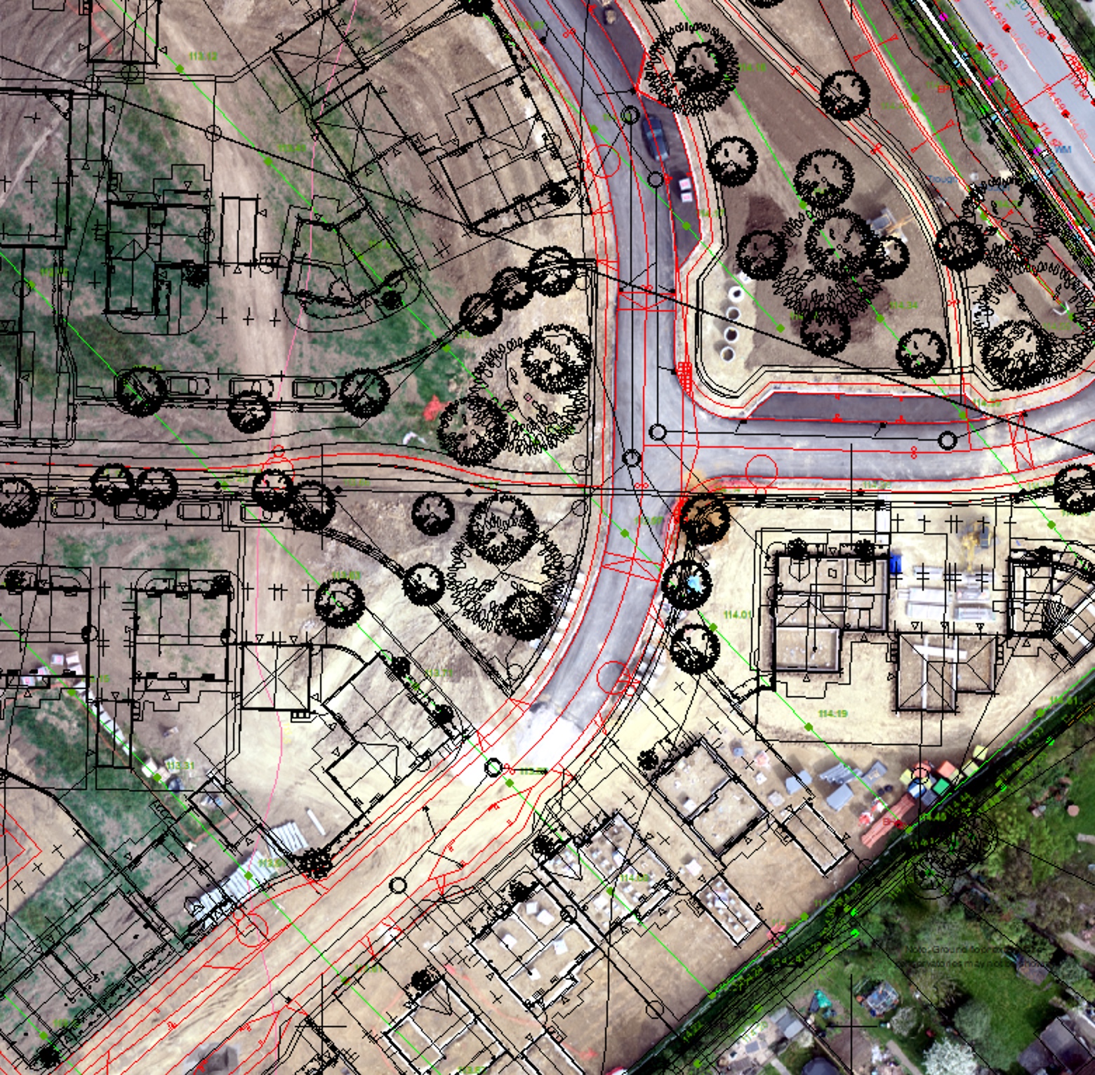
The primary output used here is the orthomosaic. An accurate true vertical image provides a snapshot at a point in time which provides an incredible amount of detail. This can be be easily compared with subsequent surveys to monitor progress (Tip - use a swipe tool to compare images).
In addition you can integrate the drone outputs with other data you have for example CAD data showing the detailed site layout.
The image here shows a typical construction site at the early stages of development. The site entrance and access road has been constructed with intial work starting on the first houses.
Project Managers, Site Managers and ground workers and others utilise this information to check progress against the detailed site layout plans.
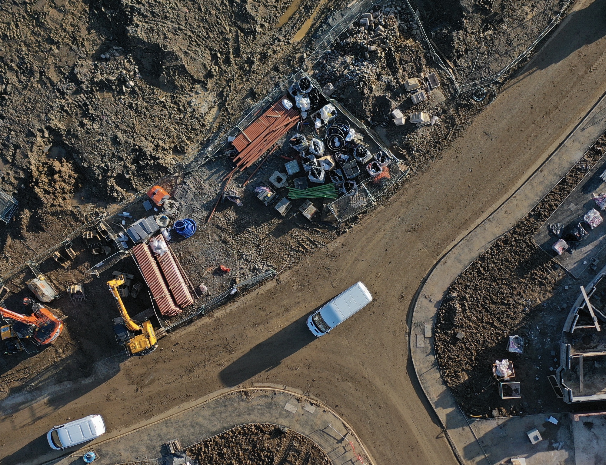
Good Housekeeping
No surprises that tidy sites are efficient sites and the ones which run smoothly, have fewer accidents, have better stock control and probably result in better margins for the operators. There is no hiding from a detailed aerial image. I have one client who relied on monthly photographic site updates provided by the Site Managers. Firstly they are going to be staged, no Site Manager is going to send in bad pictures, secondly they can be very selective.
Drone imagery told a different story and in that case over a 12 month period good housekeeping standards have improved.
Health & Safety
A picture tells a thousand words. They can certainly make highlighting site hazards much easier. By using a current and accurate aerial image it can be used to show for example first aid points, emergency assembly points, vehicle routing, pedestrian walkways, chemical and fuel stores.
As and when any of these change the imagery can be updated and continue to provide upto date information.
An ideal use for these plans is to have them printed and laminated at A1/A0 size and displayed in the site office. Certainly makes inductions much easier.

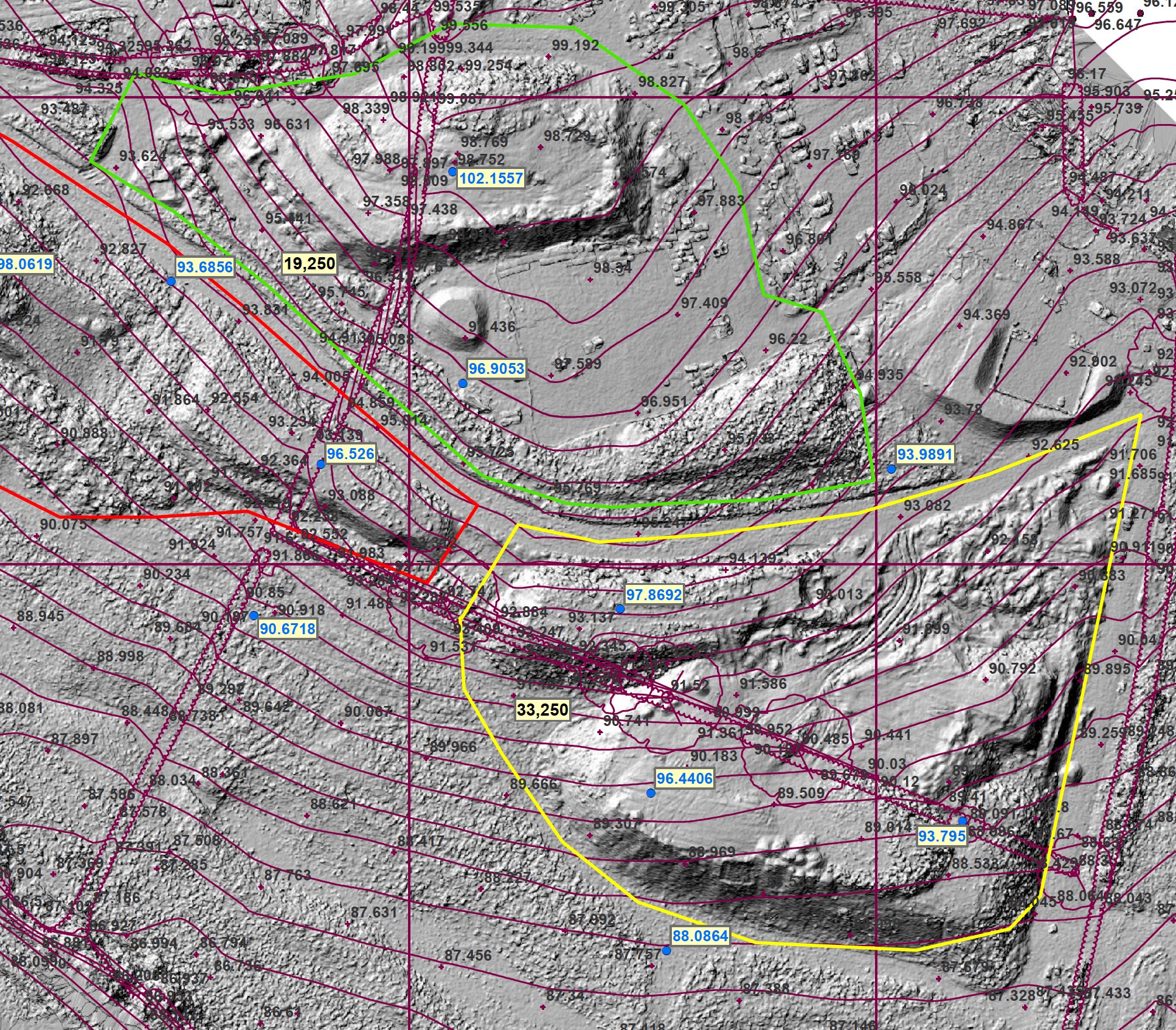
Volumetric and Elevation Data
The ability to create comprehensive 3D models, DEM's and point clouds from photogrammetry provides a whole range outputs which include the ability to undertake volumetric calculations. Quite recently I worked with a colleague to survey a 350 acre site from which we were able to calculate volumes of materials moved relative to the original site survey. Modern GIS or specialist survey allows large complex DEM's to be compared and provide volumes within minutes.
If you are working on a fast moving site a regular survey can provide the contractors with upto volumes of materials moved. For another site in addition to calculating volumes we are using the DEM's as part or our evidence base for the site Material Management Plan.
In conclusion drone derived site surveys are an ideal solution for providing a wide range of data and information for anyone involved in the property and construction sector. Current, accurate and good quality data will assist you in managing your sites and give you immediate access to key information.