Drones provide an ideal platform for capturing either stills or video imagery. With high resolution cameras and 4k video imagery captured is of high quality. For various clients I capture imagery on a regular basis which has a multiude of uses.
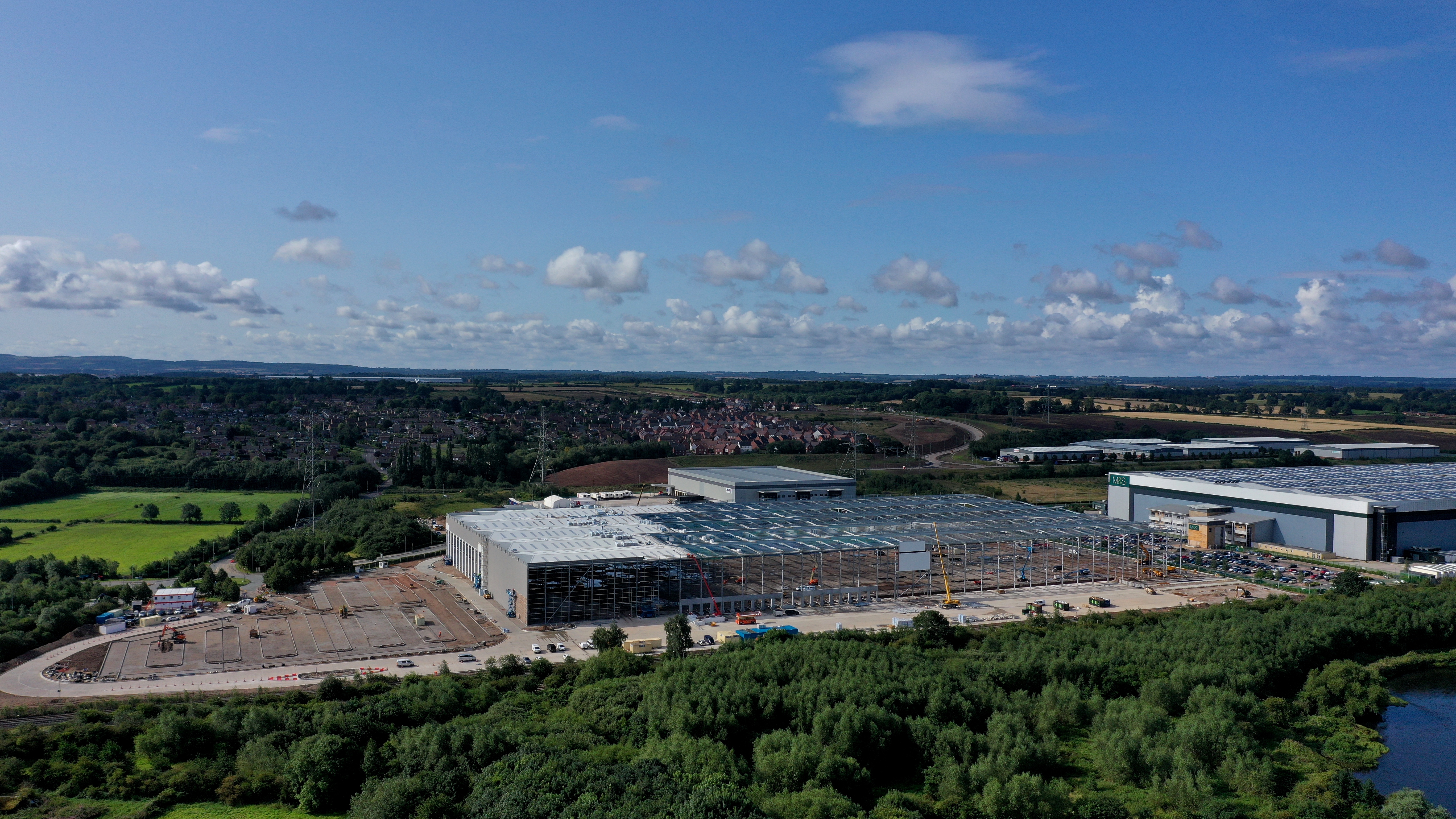
This image is of a new building at Castle Donington built by Winvic. Approval was granted from East Midlands Airport to fly in their airspace.
Imagery provided is iused in various ways from providing the senior management team with an update on the business through to site managers requiring detail.
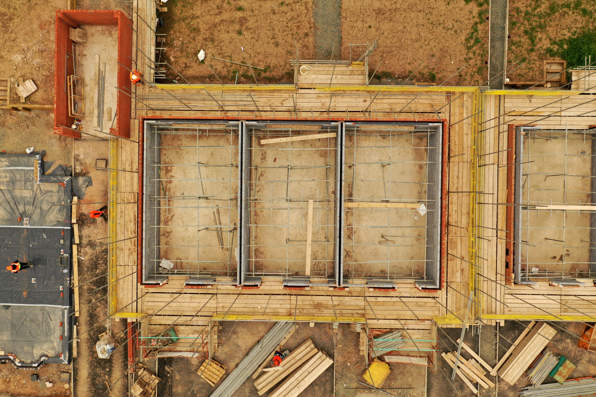
This image shows the level of detail aerial imagery can provide. Over and above "construction updates" imagery can be used for good housekeeping, health and safety auditing more recently monitoring COVID compliance.
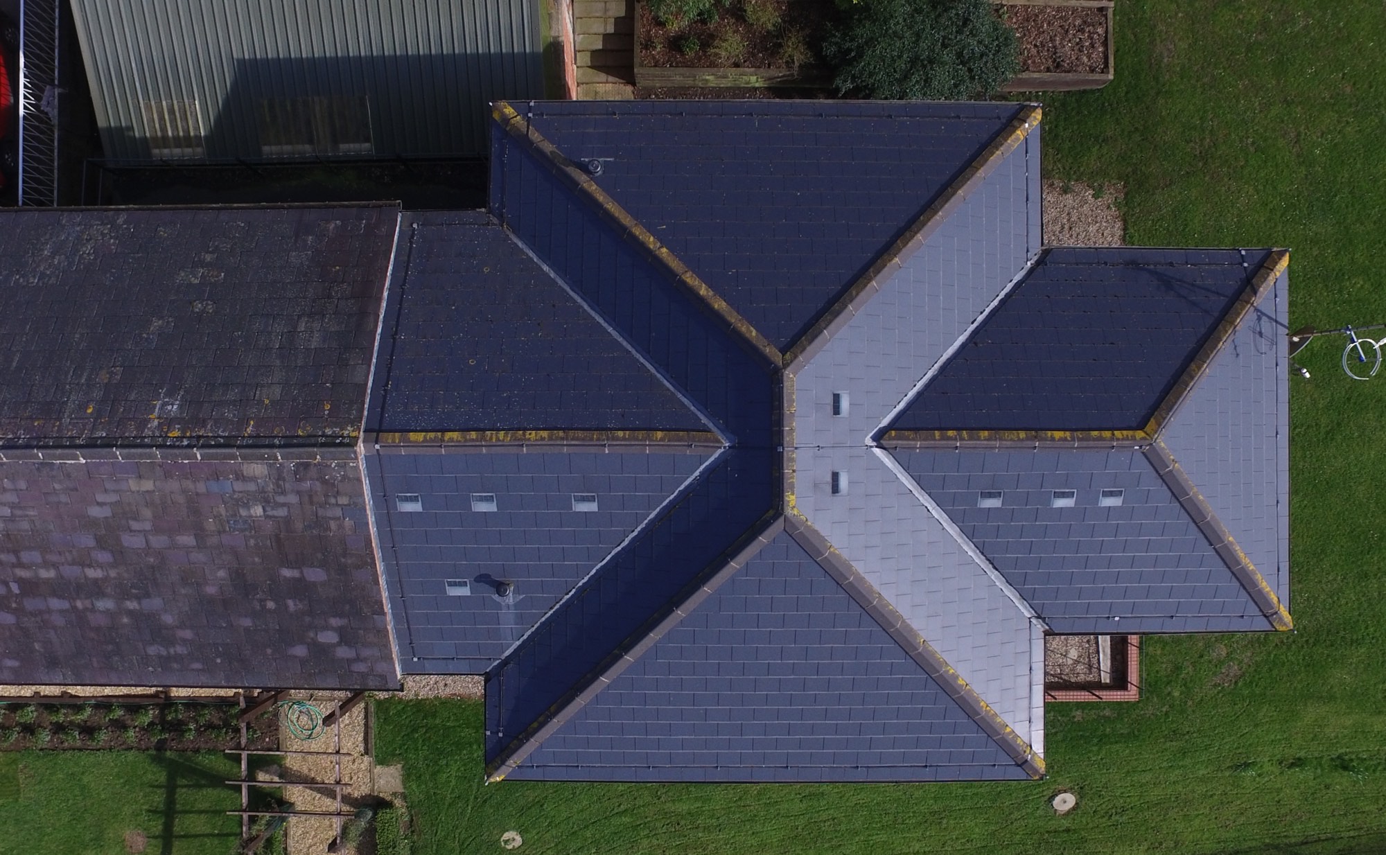
Building inspections with a drone allow details of buildings to be captured and recorded. All parts of a building can be easily photographed without the expense or inconvenience of scaffolding or access platforms. In addition on most cases inspections can be carried out quickly.
Either stills or video can be used depending on clients needs.
We undertaking roof surveys for a number of clients including various national agents. The instructions are usually for dilapidations, lease renewals or general maintenance.
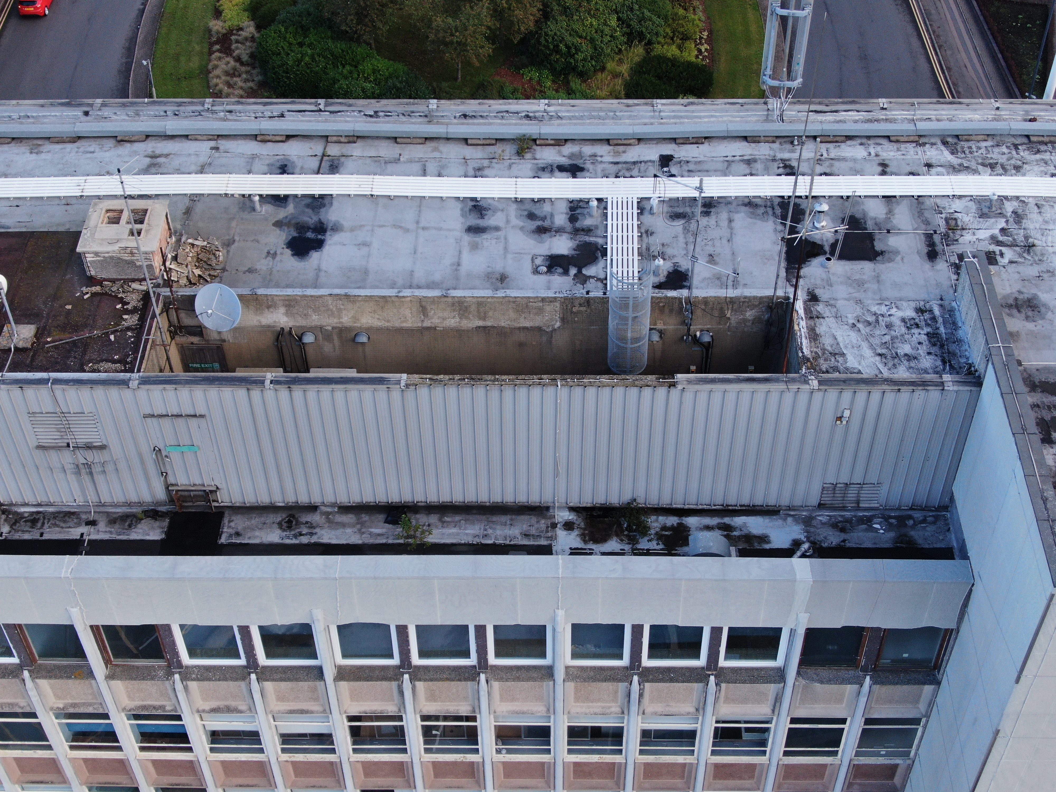
The image shown here is of a tall town centre office block where imagery was required to review ongoing management of the building. Located at the juction of two roads the imagery was captured early on a Sunday morning.
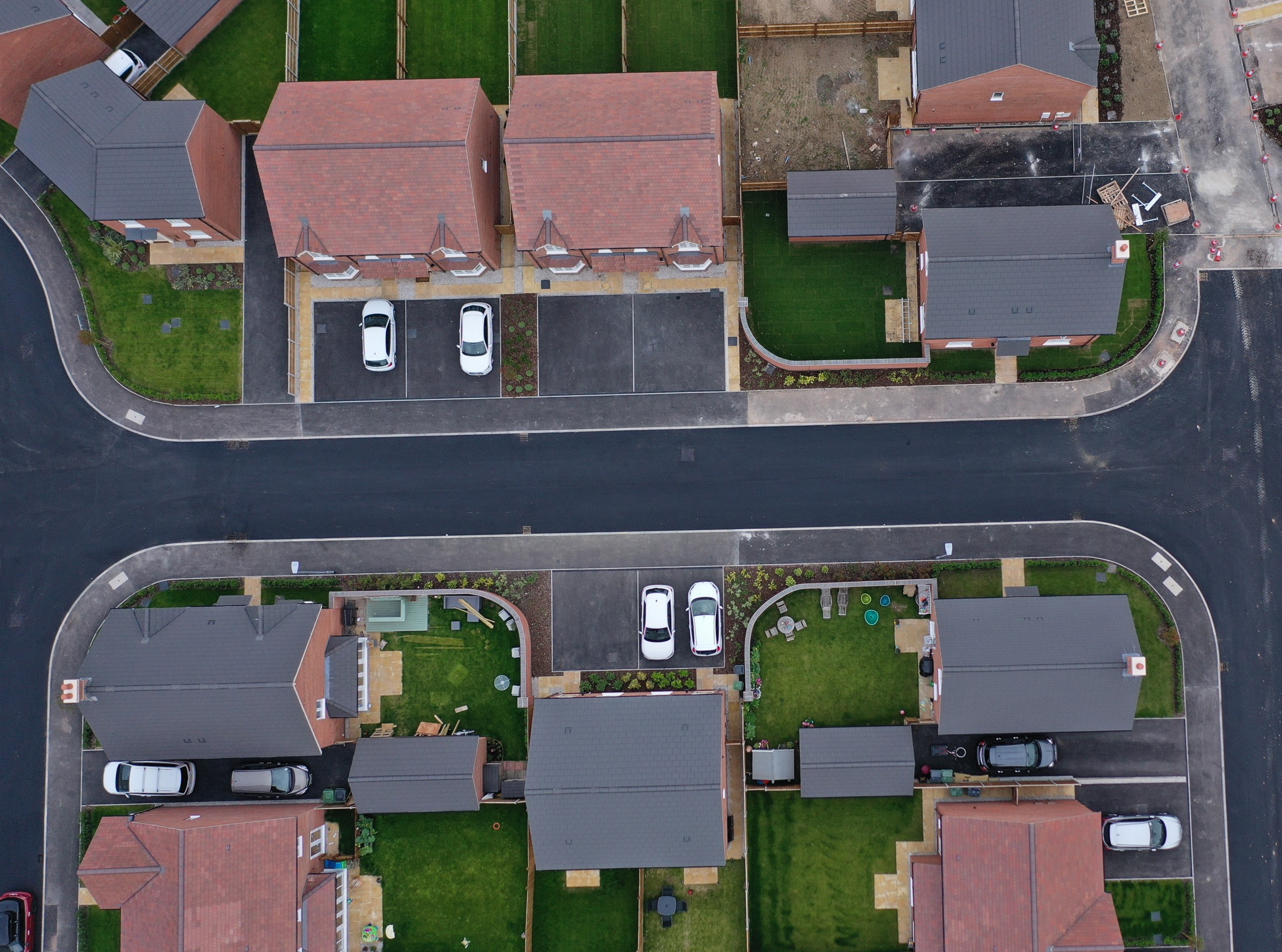
True Vertical Imagery provides the opportunity to have high resolution single images or multiple images stitched together to create an "orthomosaic". These images are georeferenced so when used in other applications such as GIS they are in their correct spatial location.
This image is an extract from a 5,000 house development project. It was one of 3,500 images captured at 60m above the take off site. Using a purpose built workstation the imagery was processed to create one seamless orthomosaic of the site.
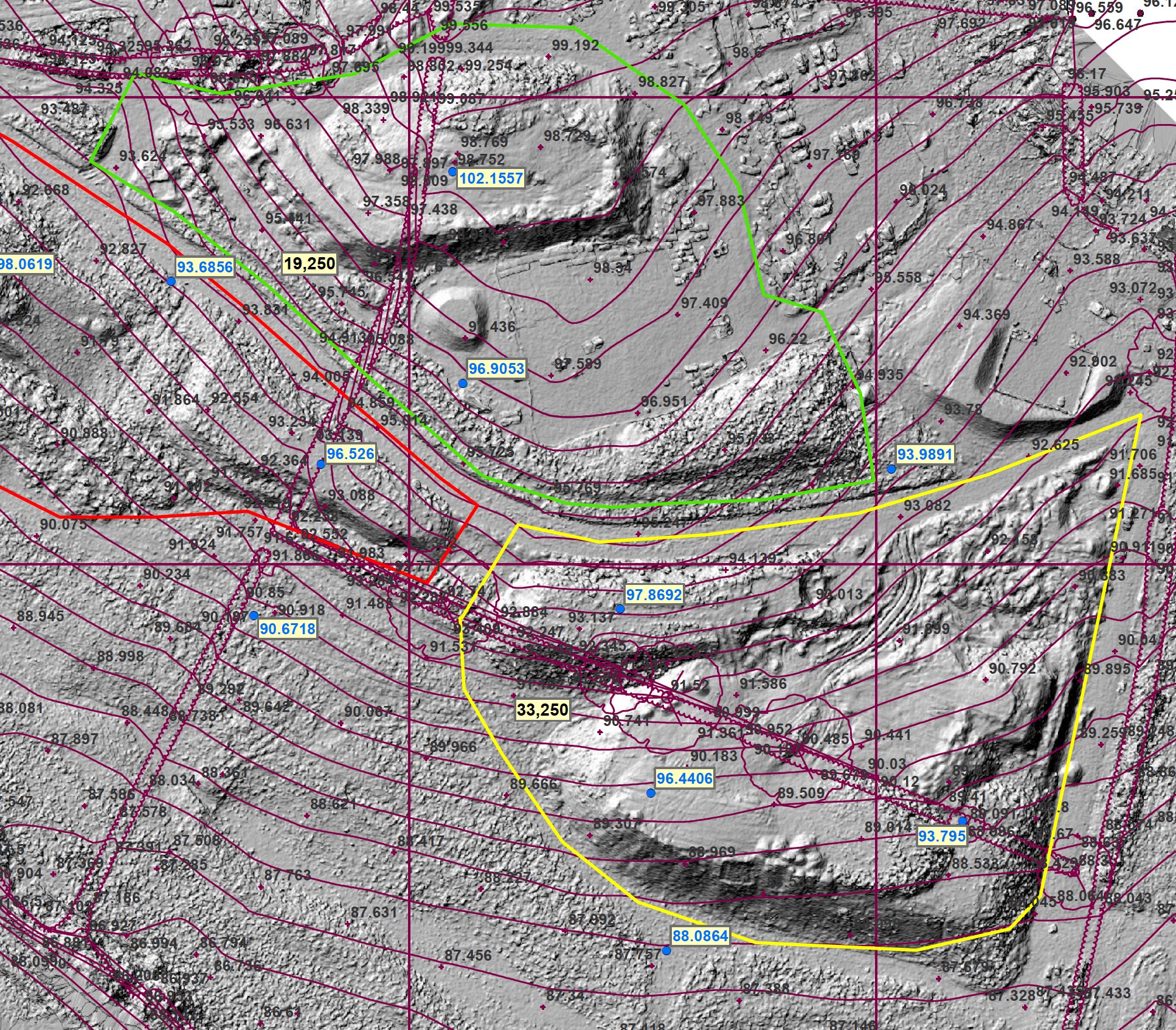
Data captured by drones can be used to create Digital Surface Models and 3D models.
Outputs from the software can also include contour mapping and point clouds. All of this data can be used in mapping software allowing further analysis to be undertaken.
A good example is volumetric surveys which the image on the left was used for. The image shows a DSM create from the drone survey plus original ground level contours together with the volumes.
With csts associated with materials management understanding quantities is important. Drone surveys can be used to provide these answers quickly and cost effectively.
Uses of imagery range from providing web site content through to general marketing. A common requirement is to provide aerial stills and video for property sales. Both formats can be edited as required by the client and everything from "red lines" added on stills through to music and voice overs on video.
Everything is Somewhere has "Permission for Commercial Operations" issued by the CAA and carry £5m of 3rd party liability insurance. Everything is Somewhere is a member of ARPAS who provide the voice for the UK UAV sector. ARPAS are a professional trade association promoting best practice and safe flying. They represent operators and UAV manufacturers and have established working relatioships with the CAA and many other key stakeholders.