Back in January I posted tests, Parts 1 & 2, of working with the SODA 3D camera and looking at the front/side overlap and how that affected the outputs. In this test I wanted to look at the effects of using different orientation settings for the camera. Note that this test didn't invlove the built environment and was a typical farm/land survey.
For anyone that isn't familiar with the SODA 3d camera it is desiged such that is swings or rotates in one plane (90 degrees to the diection of the drones flight path) and therefore allows three images to be captured, two oblique and one nadir, therefore capturing a wider field of view.
In this test I flew 4 missions all at a GSD of 2.1cm with 80% forward and 70% side overlap. Weather conditions were good being clear skies with little wind. All four data sets were processed in PiX4D. The ouputs are show below together with an earlier image captured with a Phantom 4 Pro.
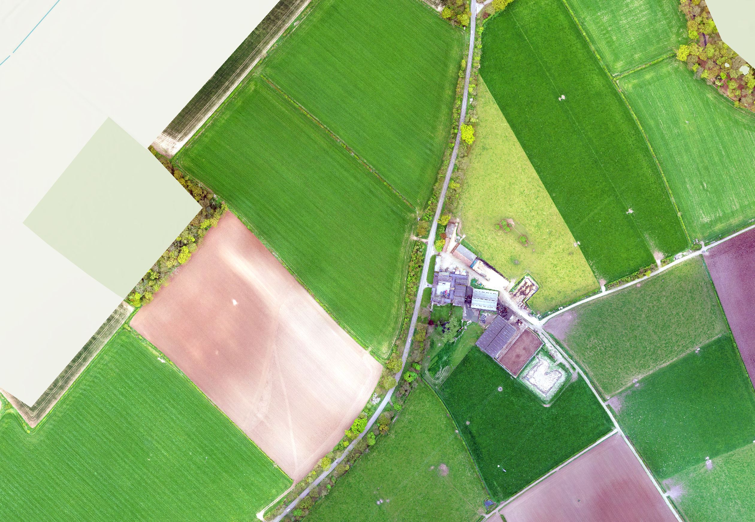
This image was taken about three years ago as part of a farm survey. What I do think is notable is the clarity of the image with very consistent colour balance. The images were processed in ESRI's Drone2Map.
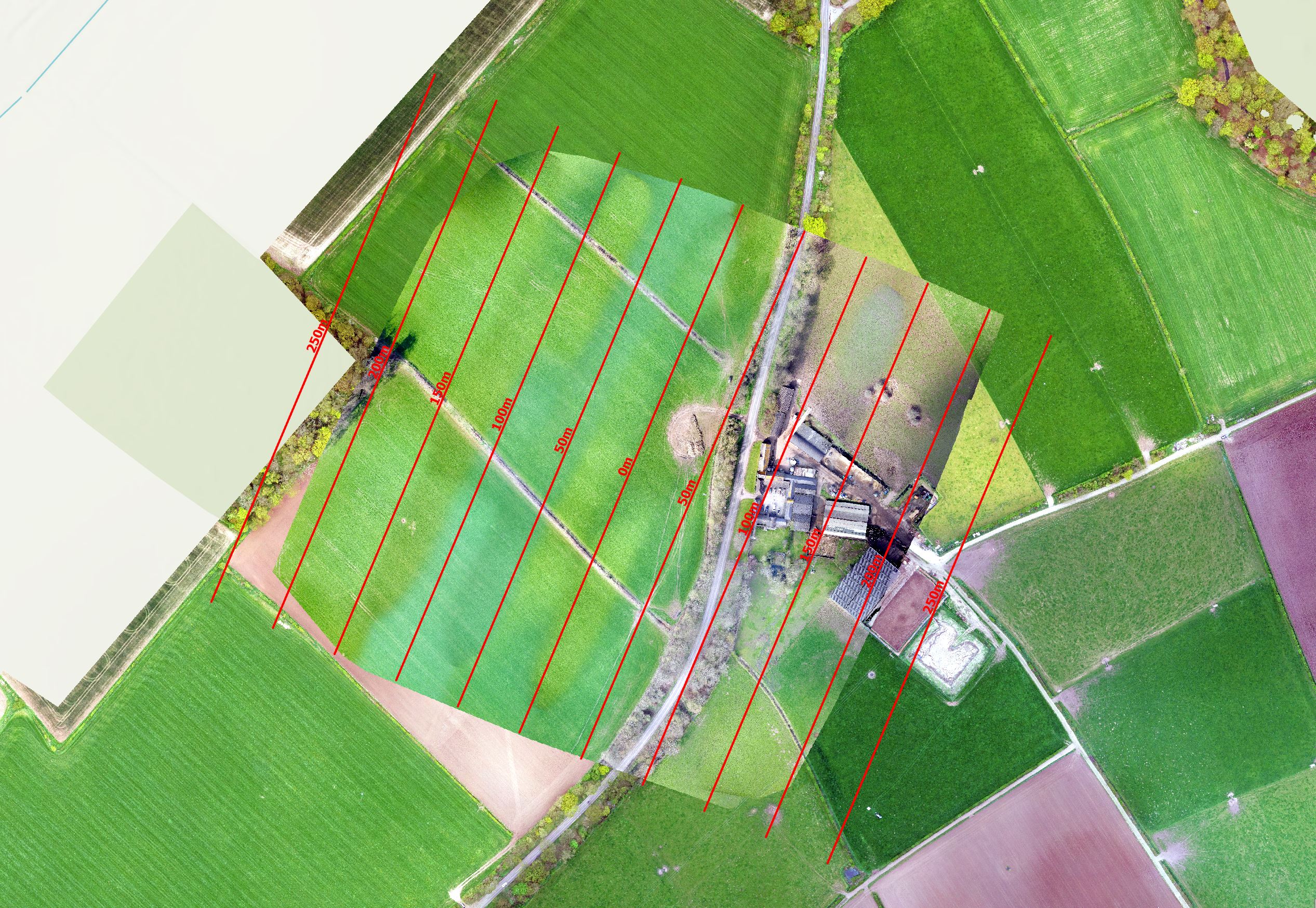
The image was captured with only nadir shots being taken. It is evident that the images do appear in lines and note that the overall coverage of the image was just over 200m from the centre line.
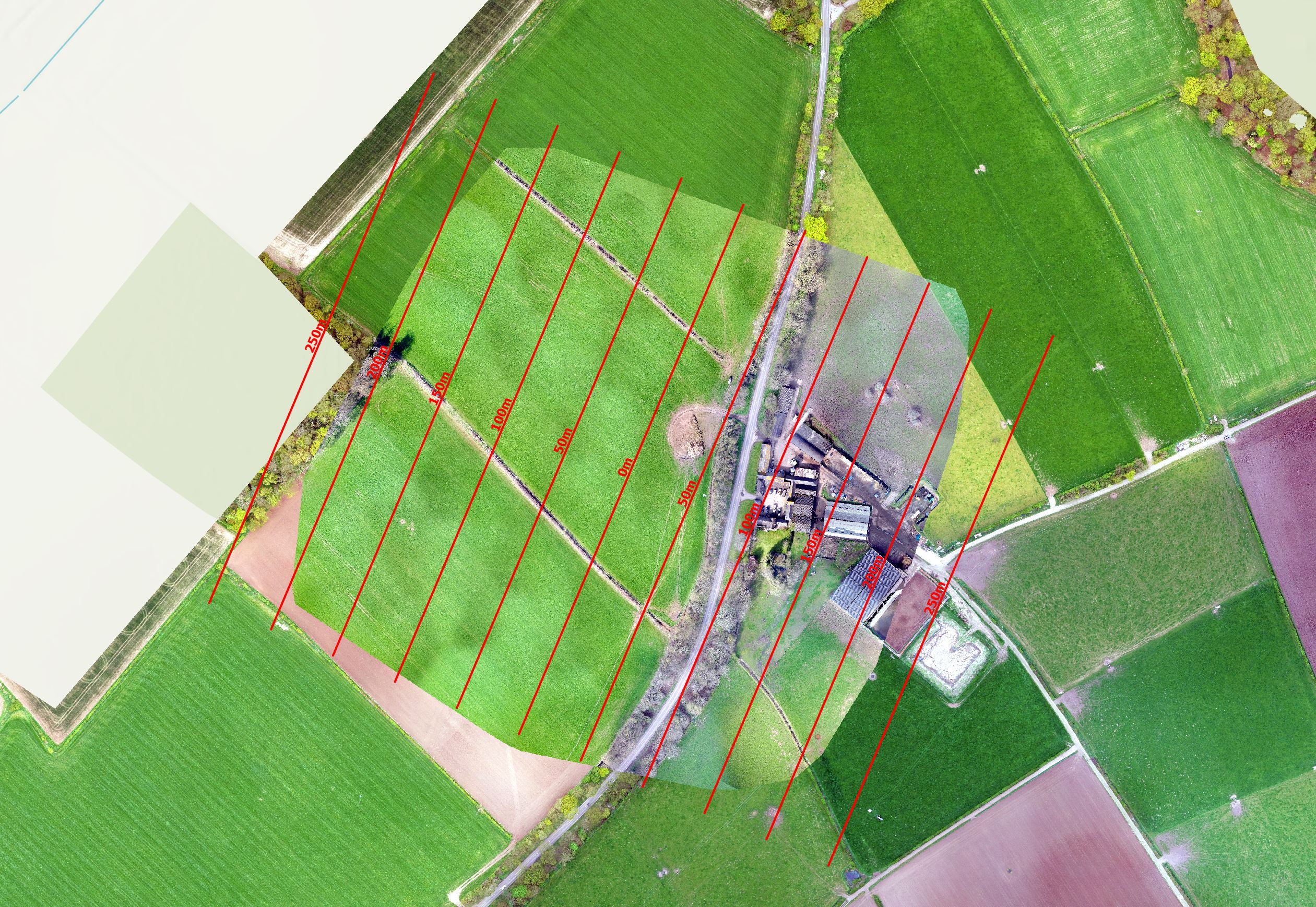
The image was captured with one nadir shot and an oblique shot either side with the angle set at 10 degrees. Straightway the lines have gone although the image is "blotchy". Image coverage has extend out by a few metres.
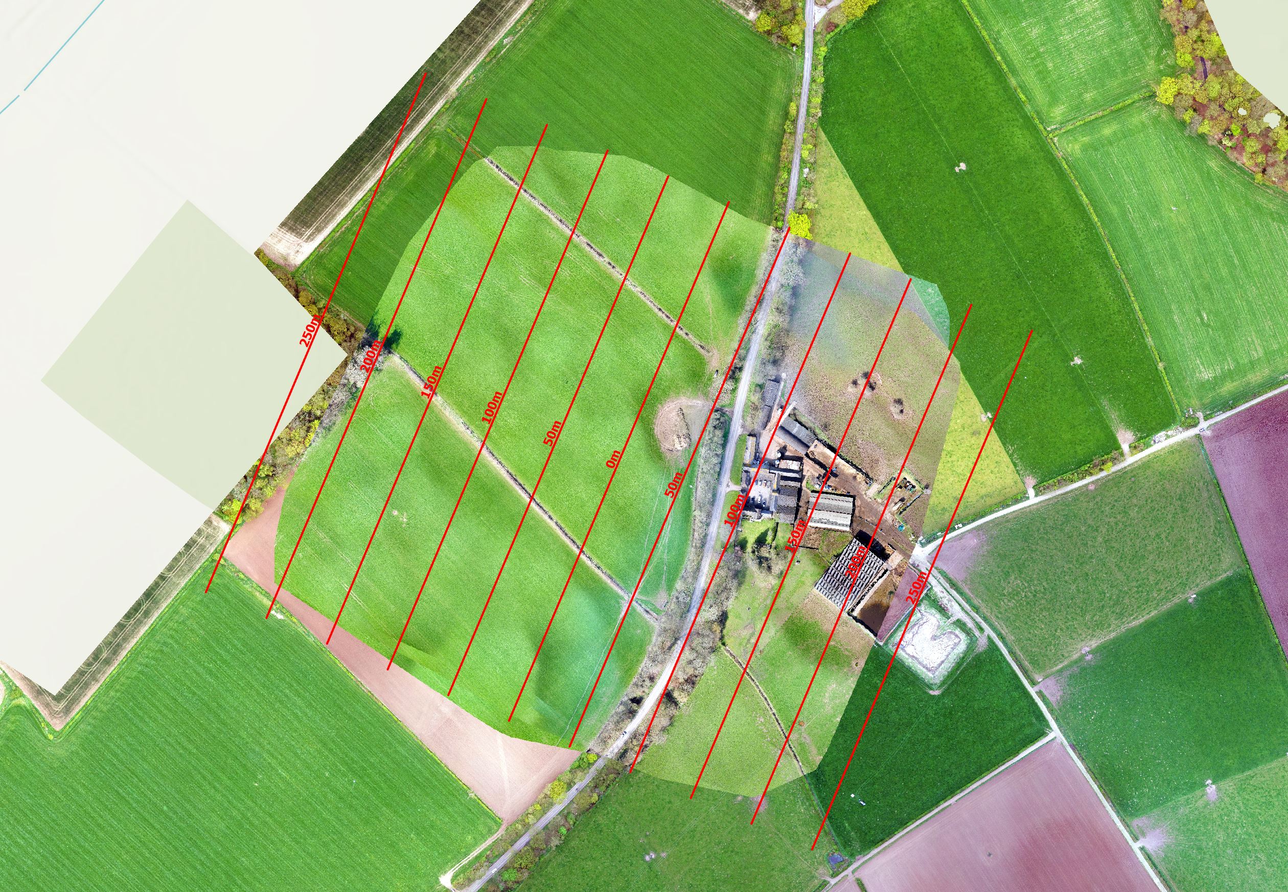
The image was captured with one nadir shot and an oblique shot either side with the angle set at 20 degrees. The image is still "blotchy". Image coverage has extend out to about 230 metres.

The image was captured with one nadir shot and an oblique shot either side with the angle set at 30 degrees. The image is still "blotchy". Image coverage has extend out to about the same as the 20 degree image, 230 metres.
From this test I think there is little difference between the camera set at either 20 or 30 degrees. As a general rule for open land I have been flying with the appropriate GSD, front overlap of 80, side 60 with the camera set at 30 degrees. This gives consistent results. Where I am filming sites with more vertical features, for example quarry faces or buildings I increase the side overlat to 70 and the camera to 45 degrees.
I want to do some more work to see if I can remove the "blotchy" images which is more evident when you have a surface of a uniform colour. It's logical that this more to do with processing than the image capture.