The initial test I undertook is on a farm where the main enterprise is a dairy unit. Historically I have mapped the whole farm to assist with designing paddock layouts as the use the "New Zealand Grazing System". In short the farm is set out to create a number of small paddocks each of c5 to 7 acres. The entire milking heard of upto 350/400 head will graze off a paddock in a few hours and then it is left for 3 to 4 weeks to regrow. The aim is to keep the cattle out as much as possible. In addition to the overall design of the farm I have mapped other aspects from infrastructure, eg water supplies and troughs though to muck heaps where we need to keep them away from water courses. Other work has included looking at slope analysis.
Given that the growth of grass is fundamental a lot of data is already collected to facilitate its managment. This will include everything from recording when it was last grazed, fertilzer applications and every week the growth and dry matter for every field is measured and recorded. The next stage is to look at grass health.
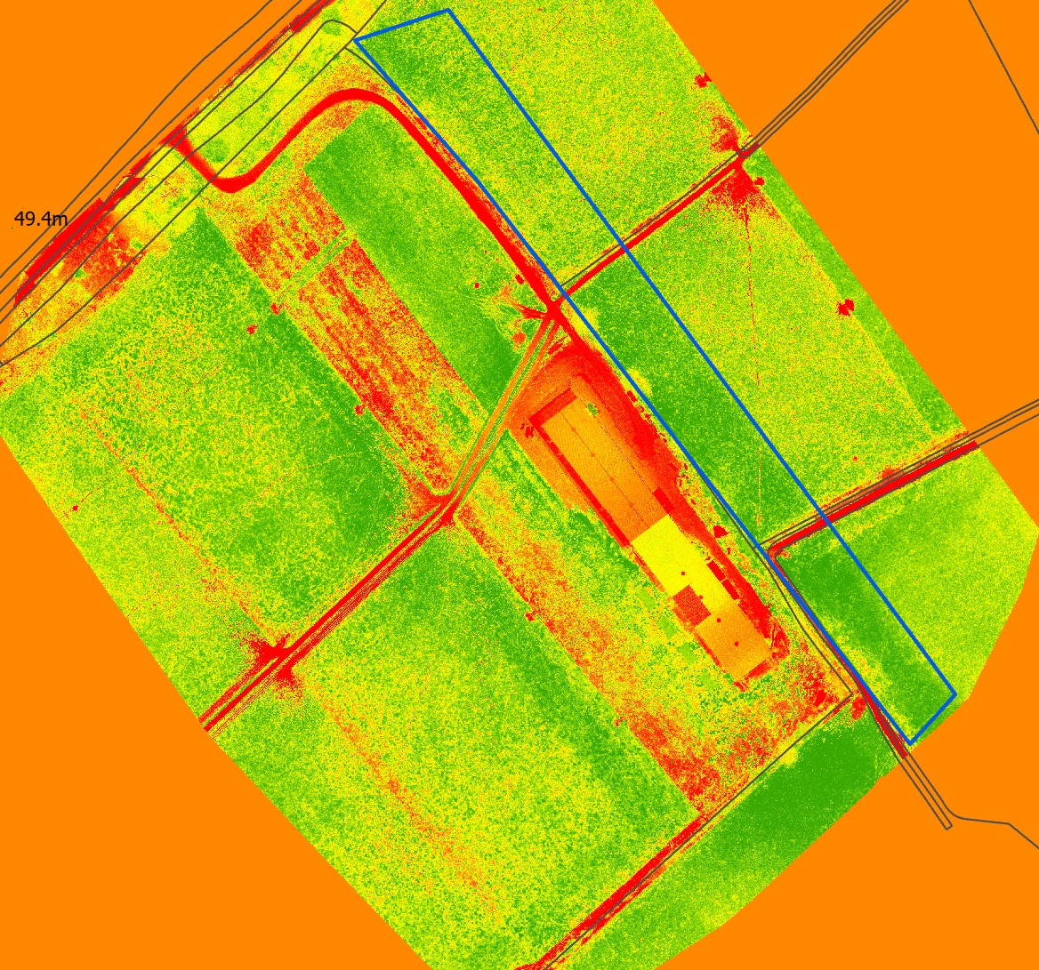
We decided to do an initial survey of a small area which included paddocks, some tree planting areas and within it are buildings and tracks. The flight was undertaken at 60m above take off point with 80% front and 70% side overlap. The data was initially processed in PiX4D and then analysed in ArcPro. I used in built tools to create a NDVI Index.
I have shown below an extract of the survey. Most of the output it as expected although we do have an unusual area which as yet we can't fathom out. With reference to the image below I have shown an area edged blue which you will see is a darker green. The farmer and I have walked the fields and at present the only thing he can think of it that additional slurry was spread over these areas. This may be true for one field but it appears to run across all three. Over the next few weeks we will experiment with the rest of the farm.
