Farms, soil management, run off, drones and GIS - solutions.
Last year I mapped a farm for a client, a new holding (800+ acres). He wanted to implement the New Zealand Grazing System on part of the farm. With a colleague we undertook a photogrammetry survey using quad drones. From the outputs I helped my client map the farm, design new paddocks, gates, water trough locations and new tracks. That was all done using ESRI's Drone2Map, ArcPro and Field Maps.
I then used ESRI Fields Maps together with a Trimble Catalyst to peg out on the ground all the new fence lines etc etc. Over the past few months all that work has been completed.
Now that infrastructure in place I resurveyed the farm yesterday using an AgEagle Sensefly eBee X and processed the data over night in PiX4d. Just need to check all fence lines correct and map where all the new troughs have been put in plus the pipes feeding them.
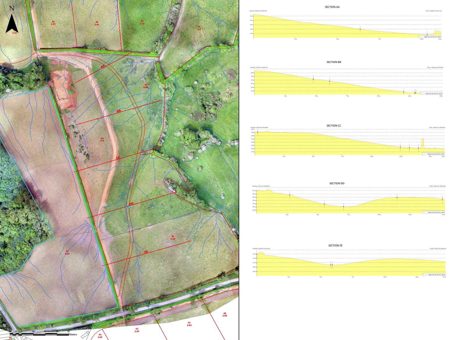
This morning my client rang. Question was how could he work out the surface water flows over the whole farm as he wants to understand run off relative to water courses. GIS once again to the rescue, this time Global Mapper was deployed. This programme is excellent at analysing data, editing point clouds and much more. I created a water shed for the whole are surveyed based on 1m x 1m squares.
I exported the outputs and in ArcPro overlaid the watershed over the orthomosaic. I added buffers to the watercourses. Large A0 plan produced which we will be reviewing tomorrow.
I think this is an excellent example of how drones and mapping can be used to enable landowners make informed decisions. It's quick, the drones produce high quality data and are cost effective. GIS allows you to undertake very detailed analysis. The next task we are looking at is environmental improvements and again the drone data will be key, in particular the orthomosaic.
The plan below shows the ortomosaic together the water shed and cross sections.
