November 30, 2024
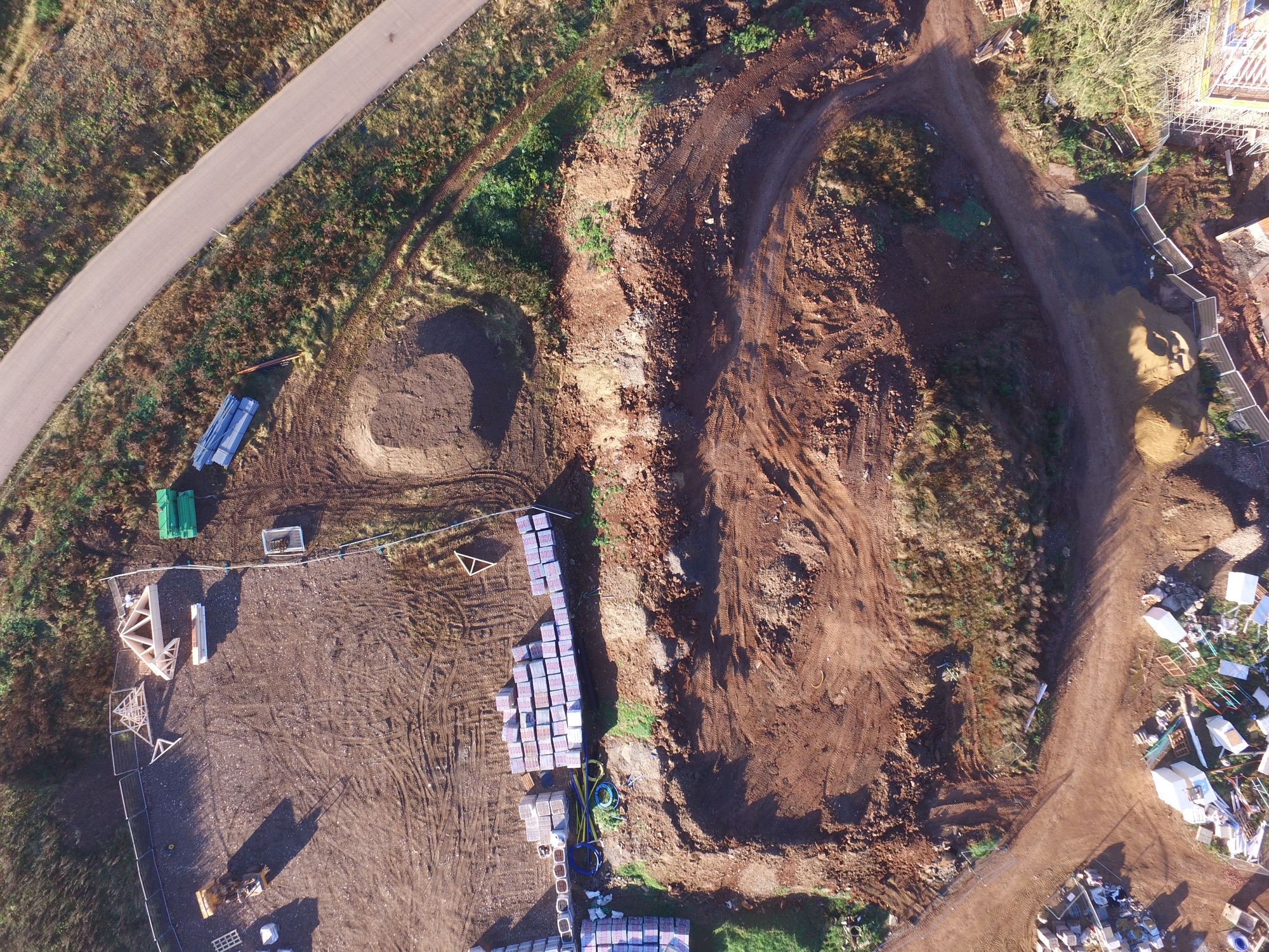
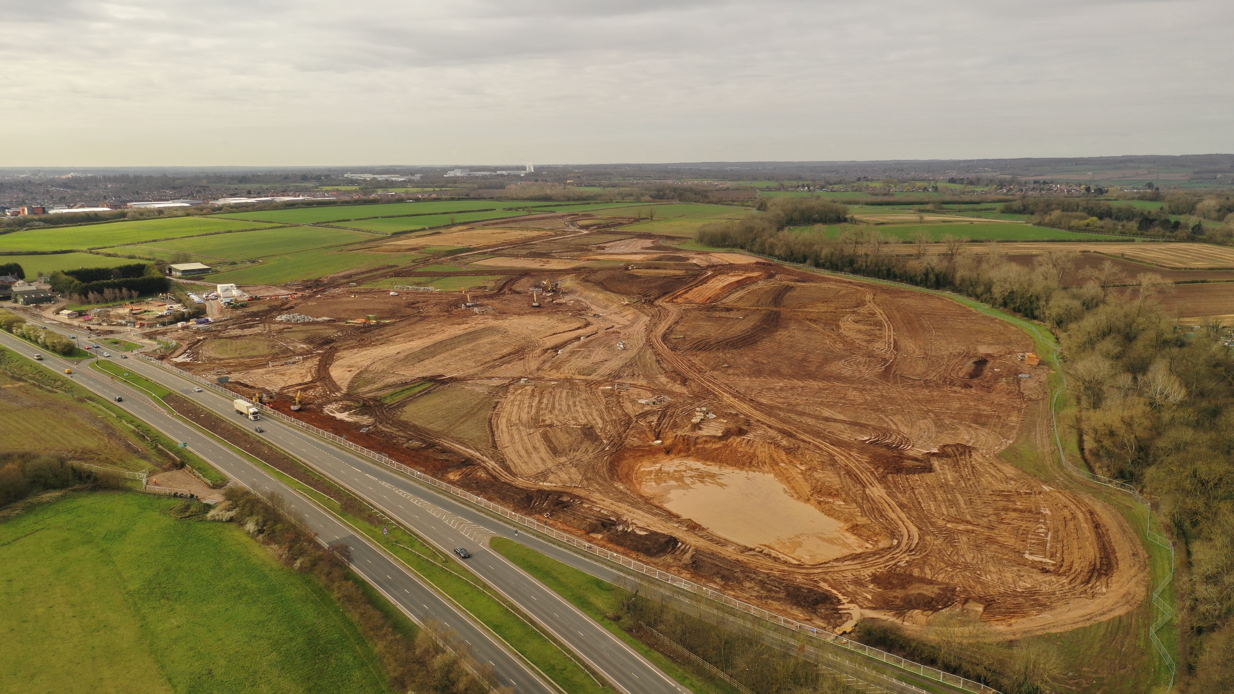
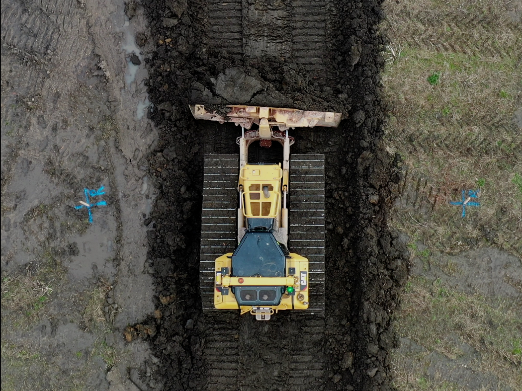
A review of undertaking a photogrammetry survey of a 660 acre landfill and quarry operation in late November. Some challenges including the winter sun (as in low), site conditions being cold in part, wet, very muddy, site inductions, RTK covergence, seagulls and wind. However all done 6500 photogrammetry images captured, 250 aerial stills, many Gb of video all done within 28 flights.
December 28, 2023
With a few days remaining of 2023 I don't think I will be doing any more flying.. At the year end I always like to review how much use I have got out of my drones and that has amounted to 1,978km which is roughly from my home to Rome. This blog covers a brief review of the data.

December 21, 2023
Undertstanding how a new drone performs and importantly the outputs it can generate is fundamental. When you have been using any particular drone for some time you get to know it quirks (if any) and how to use it efficiently. The Mavic 3 Multispectral (M3M) replaces a Phantom 4 Pro which had performed faultlessly for many years. As part of learning to use any new drone I spend some time undertking a number of test surveys. This blog takes a look at the results.
December 21, 2023
Having purchased a DJI Mavic 3 Multispectral (M3M) primarily for survey work I also plan to get back into undertaking "crop/vegetation health" work. I did undertake some work in this sector in 2016/2017 using an Inspire 1 with a modified X3 camera. The M3M takes the data capture to a different level compared with my old Inspire with four sensors (plus the RGB) to capture red, green, red edge and NIR light. To get back into undertaking this work I have planned to attend a training course in March and look forward to the growing season to put the drone to use. In the meantime I did fly a farm which I have been undertaking drone work on for a number of years. Whilst in December it revealed some interesting results.
December 20, 2023
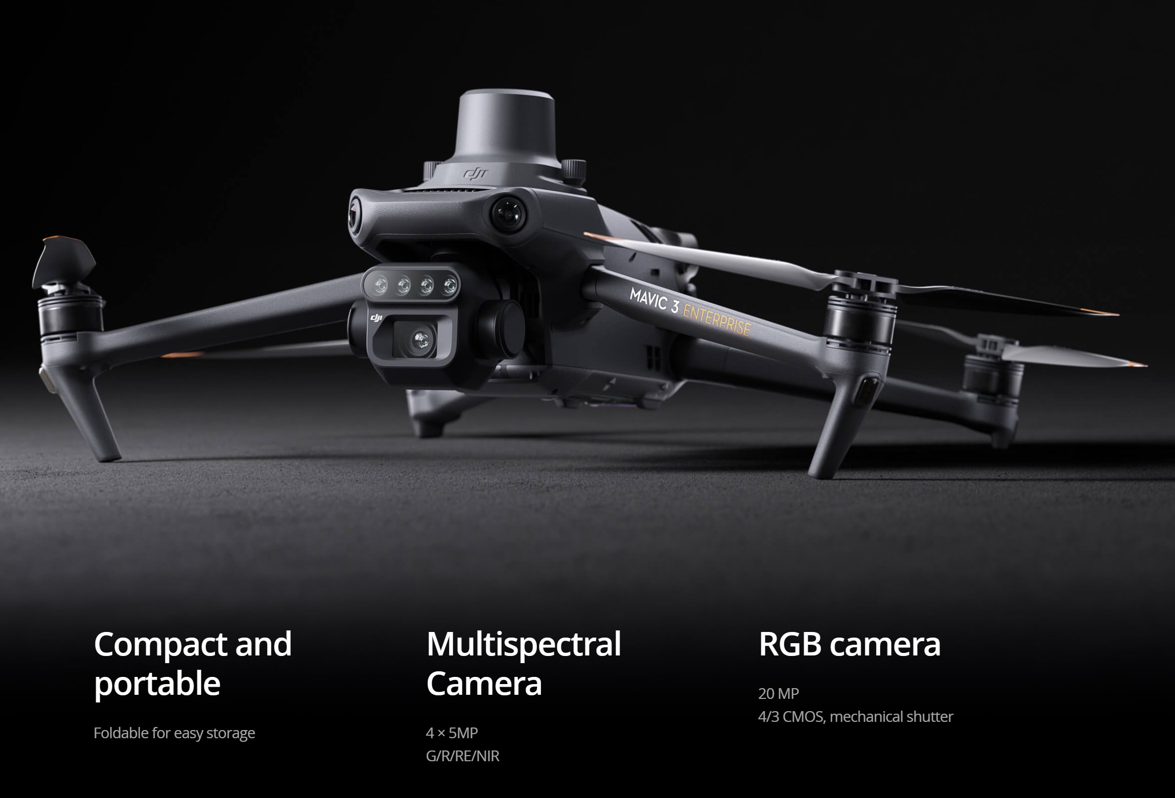
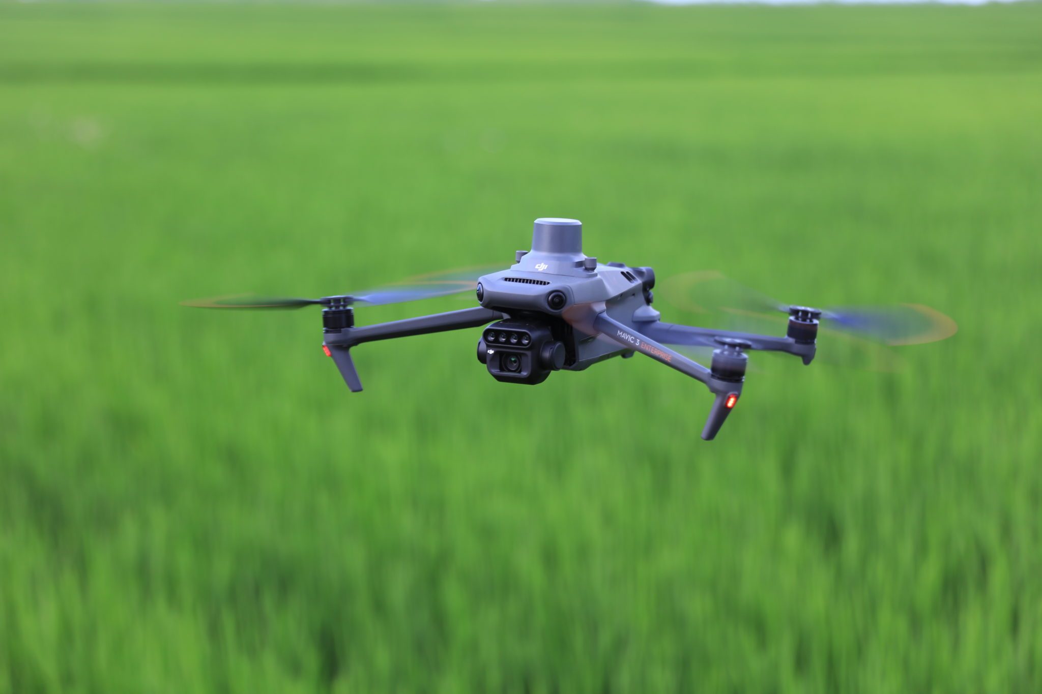
Over the past 18 months I have been upgrading various drones with the latest purchase being a DJI Mavic 3 Multispectral RTK (M3M). Others have included an AgEagle eBee x RTK and a Mavic 3 Pro. These three drones have replaced a Mavic 2 Pro, Mavic 2 Zoom and two Phamton 4 Pro's.
I have been asked why the M3M and not the Mavic 3 Enterprise, here is a brief explanation. Firsty I wanted to replace the M2P and whilst the M3E would have been OK the Pro version is better for aerial video and stills work plus having the advantage of the three lens providing 3X and 7X zoom. Having purchased the M3P I was originally going to buy the Enterprise Version which is ideal for survey work. However I didn't think I would use the second zoom lens much as I already had that on the M3P. At this point and discussing options Jim Ixer he recommended the M3M. The primary lens on this drone is exactly the same at the one on the M3E plus I would have the capability to undertake agricultural work with the multispectral lens. I have undertaken crop health work in the past but that was a while ago. Back in 2016 I flew an Inspire and purchased a second X3 camera. I then got a new lens for it from the US, dismantled the X3 and installed it (tricky!). The M3M is rather more sophisicated, here is how the first month has gone.
November 22, 2023
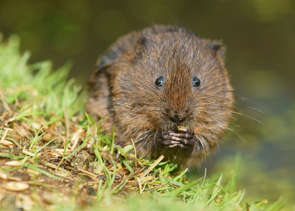
I was given an interesting commission in October which was to ascertain if water voles (and potentially other small mammals could be found using a drone fitted with a thermographic sensor. We potentially had some success although it proved challenging.
September 19, 2023
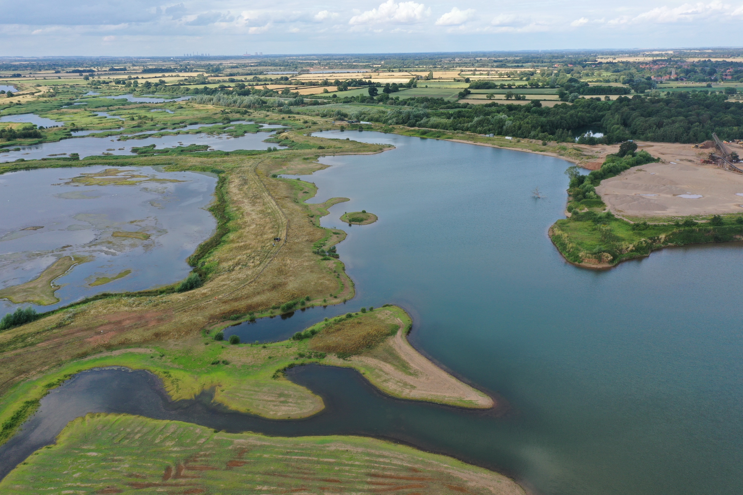
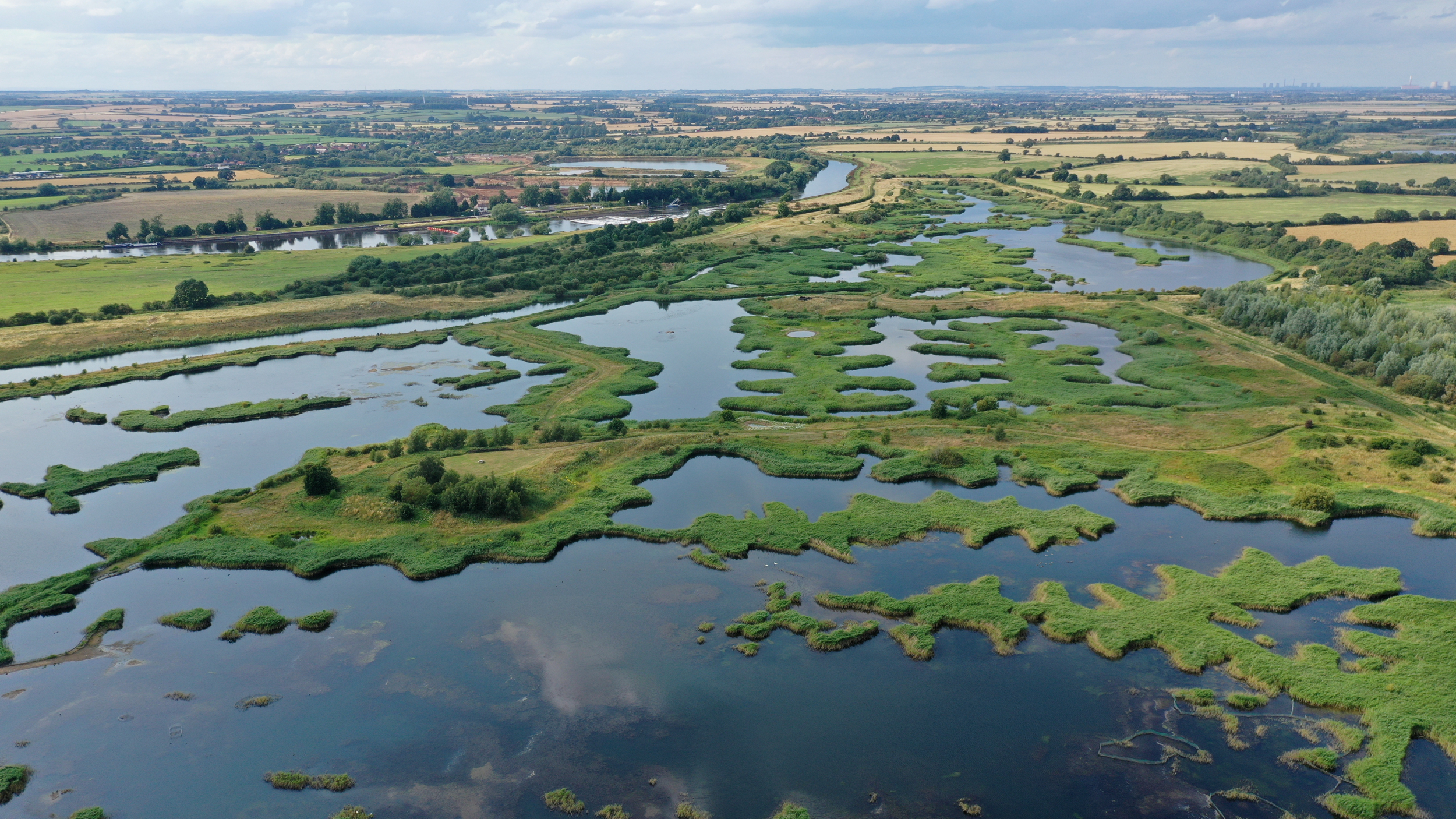
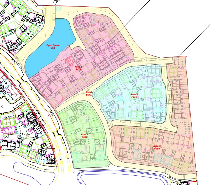
In Part 1 I talked about my involvement with Langford Lowfields and the opportunity to visit the site last year. We meet in RSPB's site office and what became immediately apparent that the ongoing management of the nature reserve was reliant on a Google Earth image. Whilst a good source of imagery for an overview the resolution doen't allow you to see the required level of detail. This image thought was about the only option the RSPB had other than using oblique imagery. This led to me offereing to undertake a photogrammetry survey of the site as well as capturing aerial imagery.
This blog focuses on the survey work and why I landed up surveying it twice.
September 12, 2023
I have had a long association with Langford Lowfields Nature Reserve, near Newark, over a period of 30+ years. At the onset I (along with my colleagues at Tarmac) secured planning permission for a greenfield sand and gravel quarry in the 1980's. Move forward to 2023 and significant areas have been restored and the reserve has now been acquired by the RSPB. This summer I did a photogrammetry survey of the nature reserve. This blog covers the intial planning challenges and how Langford Lowfields came about.
August 22, 2023
I have undertaken a number of farm surveys using drones to collect the base data. These have mainly been dairy units and ones where an intensive grazing system is used, often known as The New Zealand Grazing System. From that I use ArcPro to "map" all aspects of the farm from the fields and buildings through to the detail such as trough locations. For a number of projects part of the process is to map new paddock layouts and plan locations for new fences, tracks, troughs and water supplies. For the last project I undertook we needed a quick way to locate proposed new features and What 3 Words was the solution. This blog explains the process.
June 08, 2023
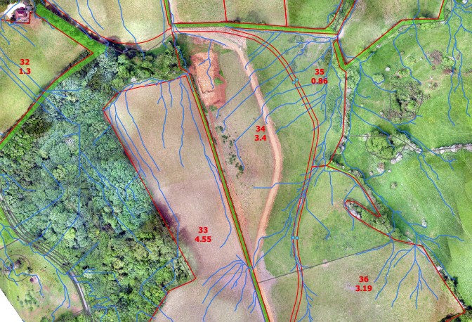
Using GIS to determine watershed for a farm and assisting with the design of new farm tracks.
April 27, 2023
In this test the focus is in the SODA 3D camera used in conjunction with an eBee X and in particular looking at the camera orientation.
March 07, 2023
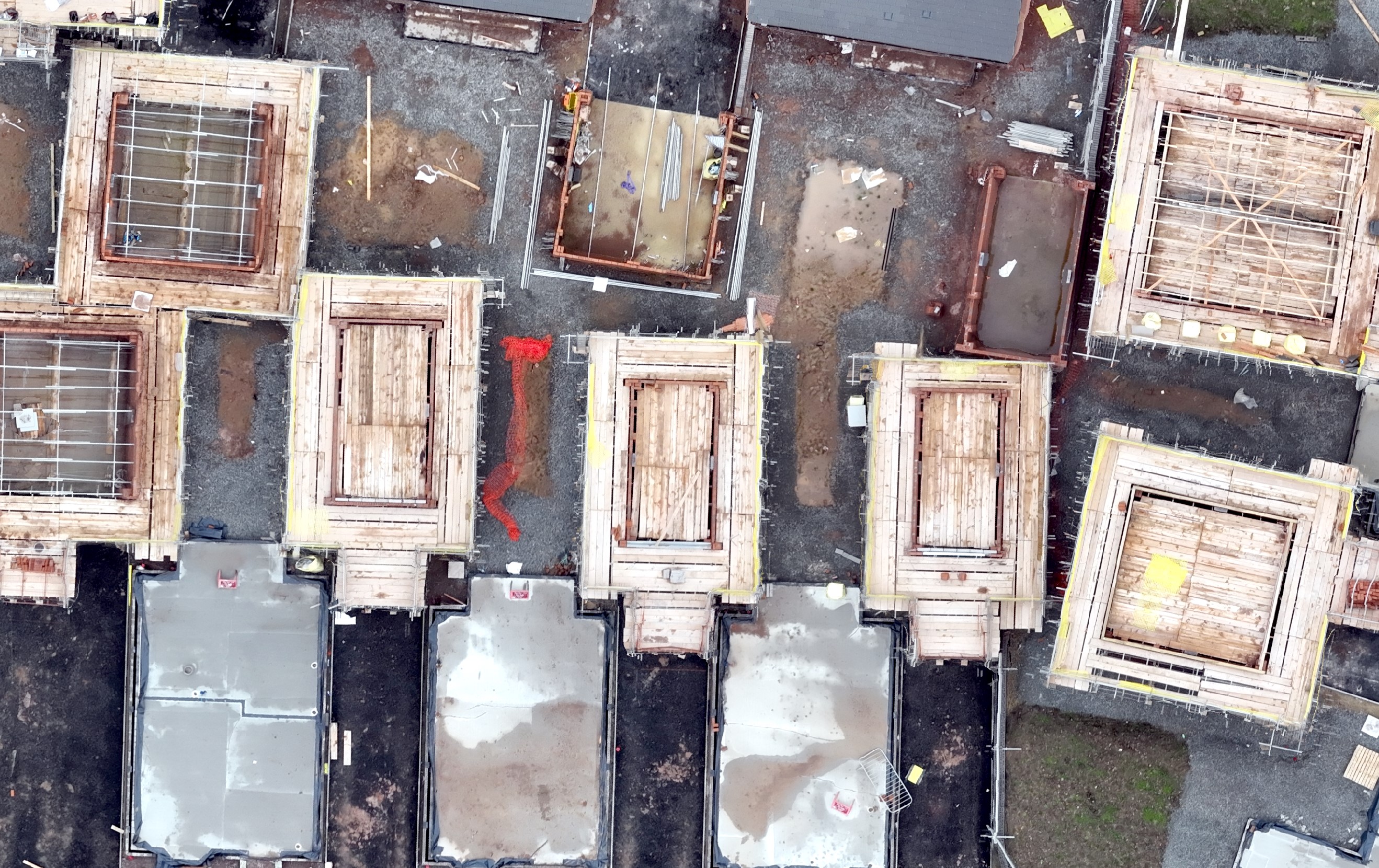
Construction Updates - how do you go about setting up a new project?
January 13, 2023
eBee X and the first 4 months. Why did I buy the eBee X, what is good (lots) and bad (little). 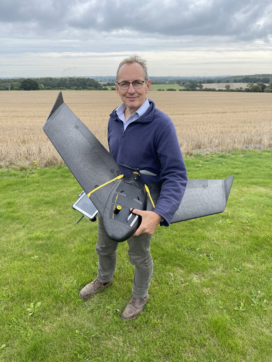
January 02, 2023
In September 2022 I purchased a AgEagle (Sensefly) eBee X from KOREC UK. Between buying the drone and the end of 2022 I had completed 68 surveys, including some training flights, and have been very pleased with the results. I have though tended to stick with the same parameters when flying the drone and wanted to experiment more.
Having looked at pretty much all of the videos I could find I discovered that there is a wide range of opinion for the optimum settings for a survey. Whilst the required GSD may vary the main area I was interested in was the Lateral and Longitudinal Settings as these (as well as GSD) have a significant affect on flight times. However the results and outputs must remain "usable".
I mainly fly and survey construction sites and to ensure the optimum results I set the GSD to 2.1cm and the Lat/Long overlap to 80/80. I have read and seen videos where the lat overlap % can be dropped to a much lower figure whilst still achieving good results. I also watched with interest to one Sensefly video where the lat % was set at 0. Now that sounds as if it would fail but I understand that eMotion calculates the minimum seperation required to capture the survey area.
The results relate primarily to the orthomosaics and have proved to be very interesting. I will follow up with a second blog focusing on the point clouds.
June 29, 2021
Drones photogrammetry surveys and volumetrics - how they can provide timely information for site managers.
April 14, 2021
The moving of soils on construction sites is an expensive business. Not only can quantities be large but often they have to be moved more than once. However as from next April with the removal of the fuel duty exemption for off road vehicles diesel costs will increse by over 45p/litre. That will further increase costs of moving materials so contractors are asking for more frequent surveys to check volumes.
March 02, 2021
Nigels headline is that
I would say;
July 01, 2020
Yesterday Boris Johnson gave his speech yesterday with the emphasis on "Build, Build, Build". There were references to the need for planning reform, reducing red tape and even a topical subject newts. I have to say that with regard to reforming the planning system and reducing red tape it does all seem to be the same old story. We accept its cumbersome and slow, yes there is too much red tape, yes it needs sorting out. Sadly I think it will follow the same pattern - ie nothing changes.
May 14, 2020
Some brief comments on what has happened since the original post. Changes appear to be happening much faster than I had anticipated.
April 18, 2020
COVID 19 has brought dramatic changes to our lives. This blog considers what possible outcomes there may be for "property" once we emerge from the ongoing lockdown. I have loooked at this from a general standpoint with focus on offices and how we work. It therefore is more applicable to the service sector and those who work in the public/private sector in offices. I haven't reflected on manufacturing as I can't really see this changing. Factories will still continue to operate where they are.
I have been reading and following various companies and it is interesting to see what trends may emerge. The likes of Savills have already published some ideas and no doubt JLL, Cushman Wakefield and the big guns will publish their thoughts (apologies if they have already).
In speaking with people and companies I work with many are thinking aling the same lines. Elliot Hartley from Garsdale Design came up with the intersting observation about the potential changes to the "High Street". Many have commented on the move away from commuting and home working.
Maybe the desrire for change will be watered down by the need to reboot the economy and return to normal. Lets see what happens over the next 12 months.
March 10, 2020
Even in professional work there is a general migration from the written word to more accessible information. We are all familiar with Facebook, Twitter, Instagram and Youtube and many of us use these platforms on a day to day basis. Web sites still have their place but there seems to be a trend here for sleek and almost minimalist websites. In general people don't wish to have to wade through pages and pages of text but still want to be informed.
When it comes to professional work you simple can't avoid writing reports, it is part and parcel of day to day life as a Chartered Surveyor. Probably the most demaning and lenghy reports I prepare are planning application statements. When combined with other technical reports the result is a healthy pile of reading material. In reality only a few will read and absorb this but there are many others who will want to know what your scheme entails. This is where I believe other forms of media, for example ESRI Story Maps and video have a role to play and convey key information in more user friendly formats.
February 18, 2020
A drone survey, and importantly the outputs, really is a "box of tricks". Who would of thought a few years ago that a drone could capture so much information in one flight and the data outputs could be used in so many different ways. As those involved in the property sector are discovering these data outputs can be used so effectively providing key information. Historically capturing this breadth of information would be not only be costly but take some time to deliver. Drones enable data to be captured quickly, safely and at a reasonable cost.
January 23, 2020
To meet the demand for housing UK plc are building a number of Strategic Development Sites up and down across the country. These are large residentiial schemes which can be any from 3/4,000 houses right upto 10,000. The development will usually include a wide range of house types, affordable housing, schools, healthcare facilities, shops, open space and all of the associated infrastructure. The question I have is when do these sites metamorphise into communities?
May 23, 2019
Firstly I have to admit I do like technology. As a Chartered Surveyor throughout my career I have used technology hopefully to its best advatange and propably considered to be an early adopter. Whether mobile phones, paperless offices, computers and apps (GIS in particular) and more recently drones I have been actively invloved. Now into my fourth year of operating drones I was encouraged to see the new RICS Insight Paper and this blog sets out my thoughts.
I do think the RICS could have published this some time ago, maybe 2 or 3 years ago, maybe that reflects that as a generality I think many surveyors and surveying practices are slow to adopt to change. With global recognition I believe that the RICS should be actively promoting and advising members of how to work smarter. Too many think of a drone as a bit of fun and something that can interfere with airports. For me it is simple another toool in the box which can be used to capture data and information for the benefit of my clients. I have one particular client in the construction sector where I capture imagey of all their active sites monthly. The CEO has described this work as "business transformational and a game changer". You have to think how and to what use an aerial camera platform can be put and what deliverables will benefit your client whther that is savoing them money, making better decisions or adding value.
This insight paper does set the scene but does rather gloss over how drones are being used today for a range of uses all of which are helping the property industry. There are some companies (eg Severn Trent, Thames Water, Knight Frank) taking a lead and doing some great work but these are a minority. The use of drones in the property secotr has huge potential and we need to embrace it.
May 10, 2019
We are now in our 4th year of opertaing a drone and the number of enquiries is on the rise. Initially drone work was focused on complimenting exisitng services provided to various cleints. Over the past 12/18 months enquiries have gradually increased for both existing and new clients. Whilst the number of qualified drone pilots has increased substantially over the past 2 years (from about 2,000 to 8,000) there remains a signifiant amount of work available. With experience in the property sector our focus is on providing drone derived outputs and data to helpo client manage their property portfolios.
April 29, 2019
Since "Gatwick" new rules have been introduced for anyone wishing to fly their drone close to an airport. How is it working?
April 02, 2019
Creating photogrammetry outoputs from drone derived imagery is well established and readily available using drones. The use of photogrammetry does seem to be on the rise as cleints realise the benefits of being able to obtain a wide variety of outputs quickly and cost effectively. Accuracy is often a topic of debate but with care the correct results can be achieved. This short blog covers how we deliver the required accuracies.
January 02, 2019
Over the Christmas /New Year Holiday I always seem to do those once in a year jobs - having a good clear out. This year I have been taking it a bit furether and not just leaving it an annual task. It has become an ongoing "Project". I don't like clutter and do like to be organised (typical traits of a Virgo) so I am endeavouring to rid myself of unnecessary clutter, this includes electronic data and information as well. Most of this is a physical process and I have done a lot over the last 6 months.
My aim this year is to take greater care with the written word. Whether it is email, making notes, drafting a planning statement, writing a report, editing a video or writing some form of manual I am going to make an effort to make it concise and succinct.
In addition I will be reviewing my UAV Operations Manual and seeing if I can or need to de-clutter it.
November 24, 2018
This Autumn has been busy with a wide variety of drone surveys. Within the last month I have completed seven surveys and have encountered a wide variety of ground conditions. In this blog I take a closer look at the impact vegetation can have on volumetric surveys.
October 23, 2018
Last month I attended a two day course presented by Andy Carman from ARC Aerial Imaging and hosted by Ely Aviation. An excellent course, a good and enthuasiatic group of attendees and we also did some flying. Read more about the course here.
September 19, 2018
I am an "old school" surveyor. Like most surveyors I love maps, old or new, I also love technology. My aim has always been to use technology to make my working life easier and to be more efficient. Effective use of time becomes very much evident when you operate as a small company or sole trader. Sadly you still still so time watsed (in meetings??) and lots of procrastination. I also, all to frequently, work with clients who at best have average and sometimes poor or very poor property records and information. You can see how inefficient this becomes and a burden of time and sometimes limited resources. This blog is therefore about property records, or the lack or them.
May 28, 2018
Having attended the ESRI User Conference I discovered that I have access to an App called Survey123. I have started using it and it is fantastic, a real time saver.
March 21, 2018
Pre Application Advice, useful, but are Planning Authorities Consistent?
November 09, 2017
Much has been written on how to undertake volumetric surveys with a UAV and whether "Ground Control Points" are needed to achieve accuracy. I conducted my own experiment using a real life project.